Adventure app
Naplánuj si vlastní dobrodružství
Importuj GPX a naplánuj si vlastní trasu do aplikace. Výlety můžeš tvořit jen pro své účely, anebo pokud tě tvorba tras baví, lze svoji tvorbou inspirovat ostatní a předávat své zkušenosti. Uživatelé, kteří tě v aplikaci sledují, uvidí tvůj obsah a na tvé trasy mohou sami vyrazit, recenzovat je anebo o nich diskutovat v komentářích.
Kde v aplikaci najdu plánovač tras?
You can open the planner from several places in the Adventurer app.
Přístup z vlastního profilu
In the section of created routes
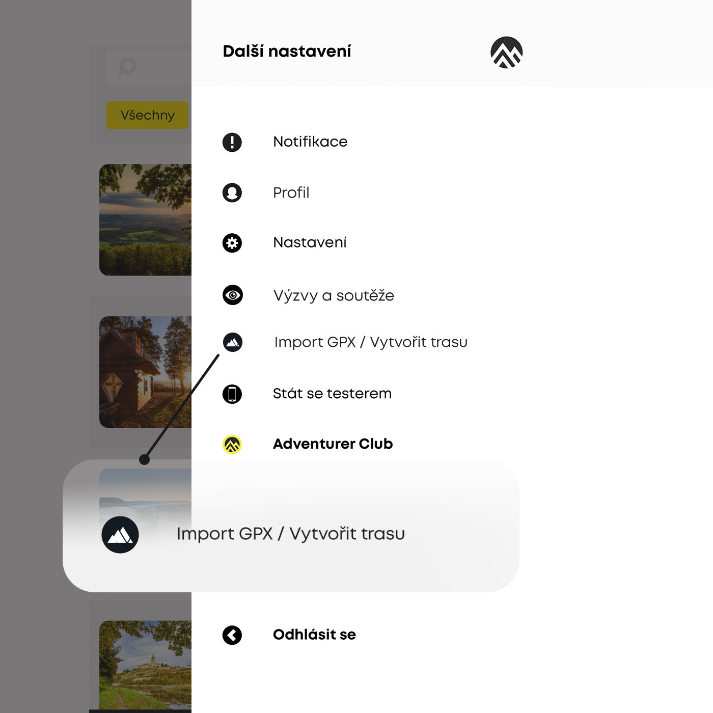
Přístup z menu
From the side menu you can click Import GPX / Create Route.
Přístup z mapy
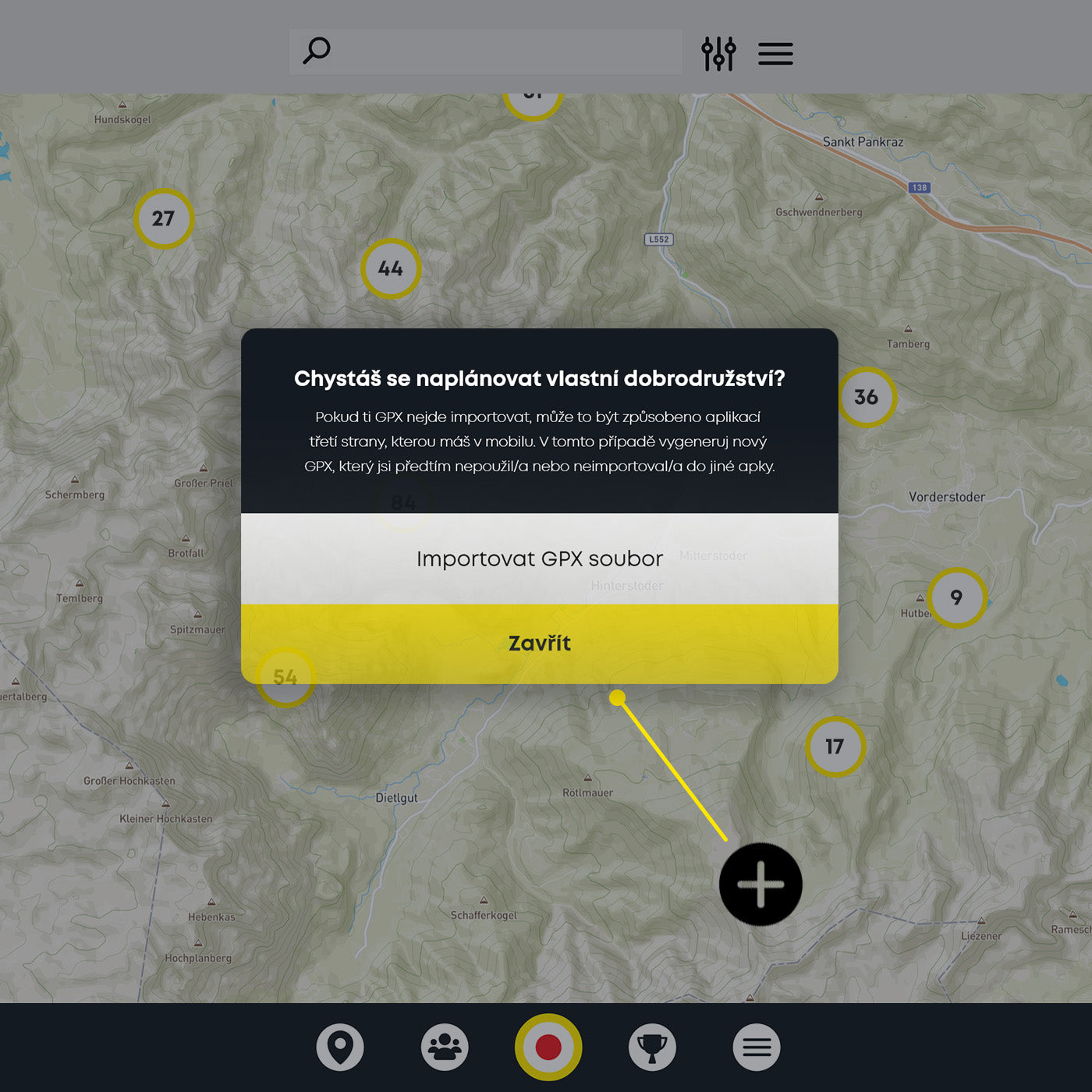
You can import a GPX file from the map using the "+" button in the bottom corner.
Jak to celé funguje?
Vlastní trasu vytvoříš během chvíle
Interakce s mapou
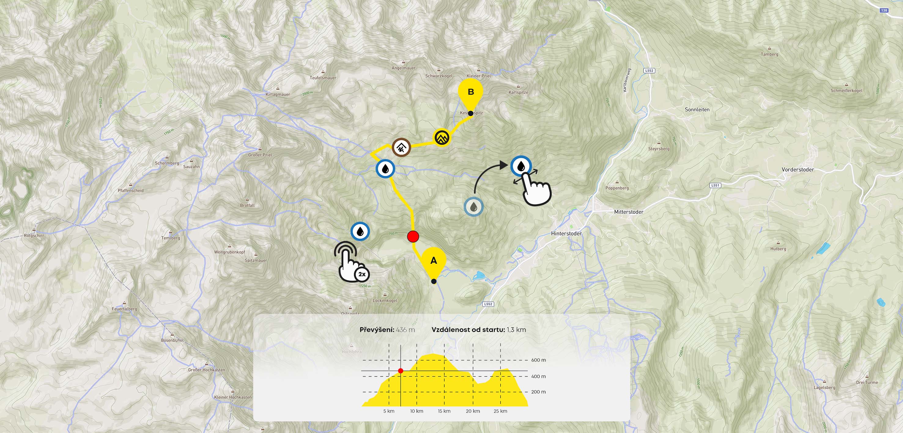
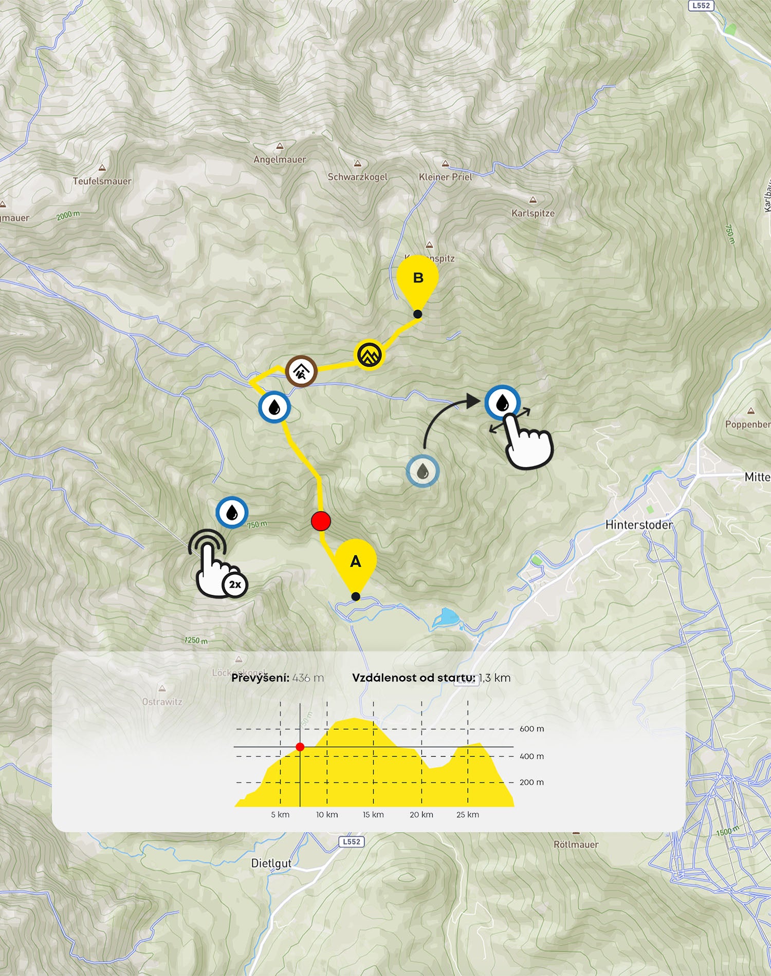
You can record all the important points on the map that you want to have a quick overview of on the route - water sources, shelters, points of interest, important peaks or castles, etc. Simply double tap a place on the map and a list will open up.
Vytvoř bod na mapě
Double-tap the map to record key points along the route, such as a water source, shelter or point of interest, and more.
Zobraz si název bodu
If you click once on the point, you'll see its name and label without opening the edit.
Přemísti bod na mapě
Dlouhým stiskem bodu zájmu a posunutím prstu po obrazovce můžeš změnit pozici. Při dlouhém stisku vyčkej, až obrazovka zavibruje.
Podívej se na převýšení skrze graf
If you click on the arrow at the bottom of the screen, you'll see an interactive graph showing the elevation of the route. By sliding your finger across the graph, you can view the elevation in a specific section.
Smazání bodu na mapě
If you double-click on a point again, you will see a delete button at the bottom of the screen below the list. Press and confirm to delete the selected point.
Doplnění údajů a parametrů trasy
Record the route parameters
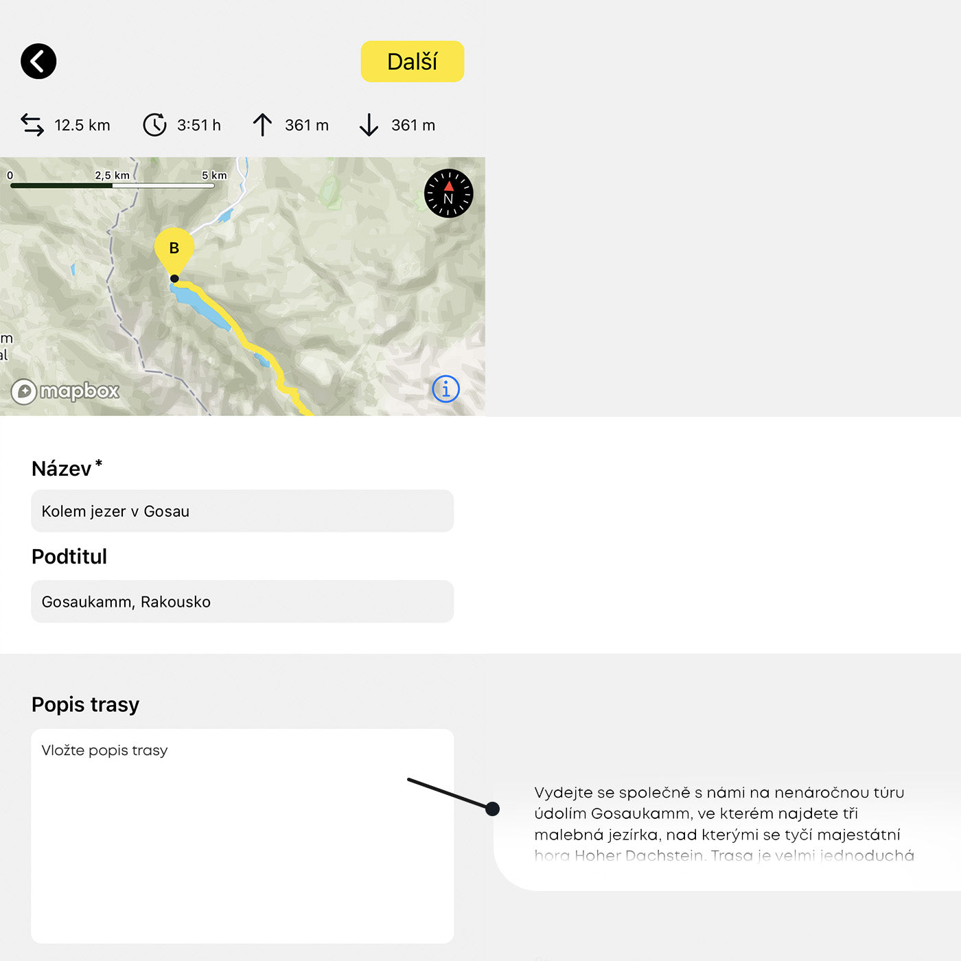
Popiš svoji trasu
Add a title, subtitle and description of your hike. You have up to 3000 characters for the description.
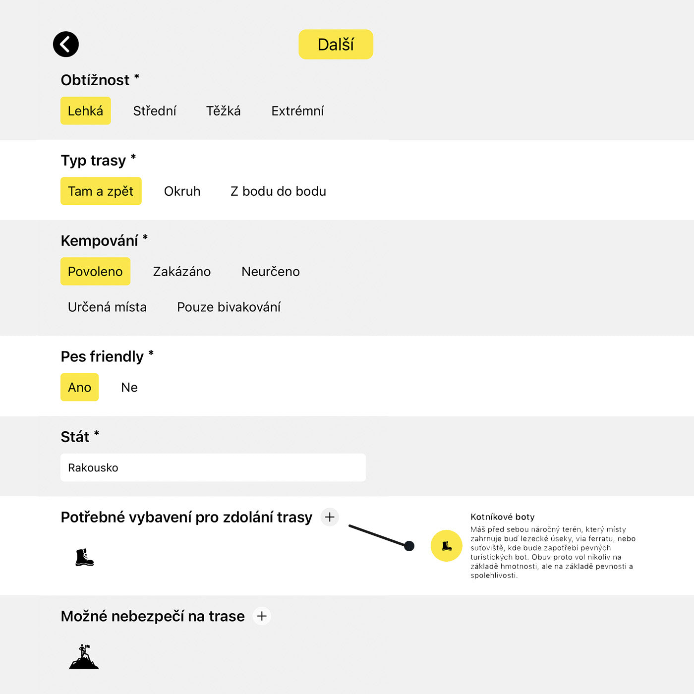
Specifikuj parametry
Specify difficulty, route type, camping options and more. You can also select suitable equipment for the climb or warn of potential dangers on the route.
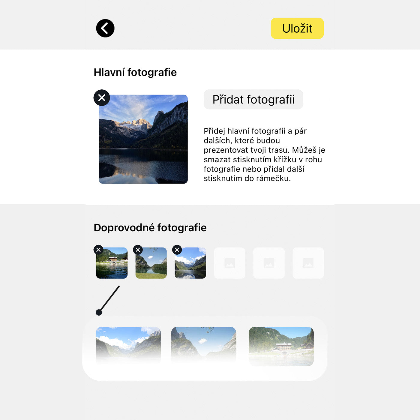
Nahraj fotografie
Hlavní foto bude reprezentovat celou trasu a zobrazovat se i v jejím náhledu. Doprovodné fotky představu o cestě dále rozvijí a zobrazují se v dolní části detailu trasy. Nahrávej fotky v malém rozlišení.
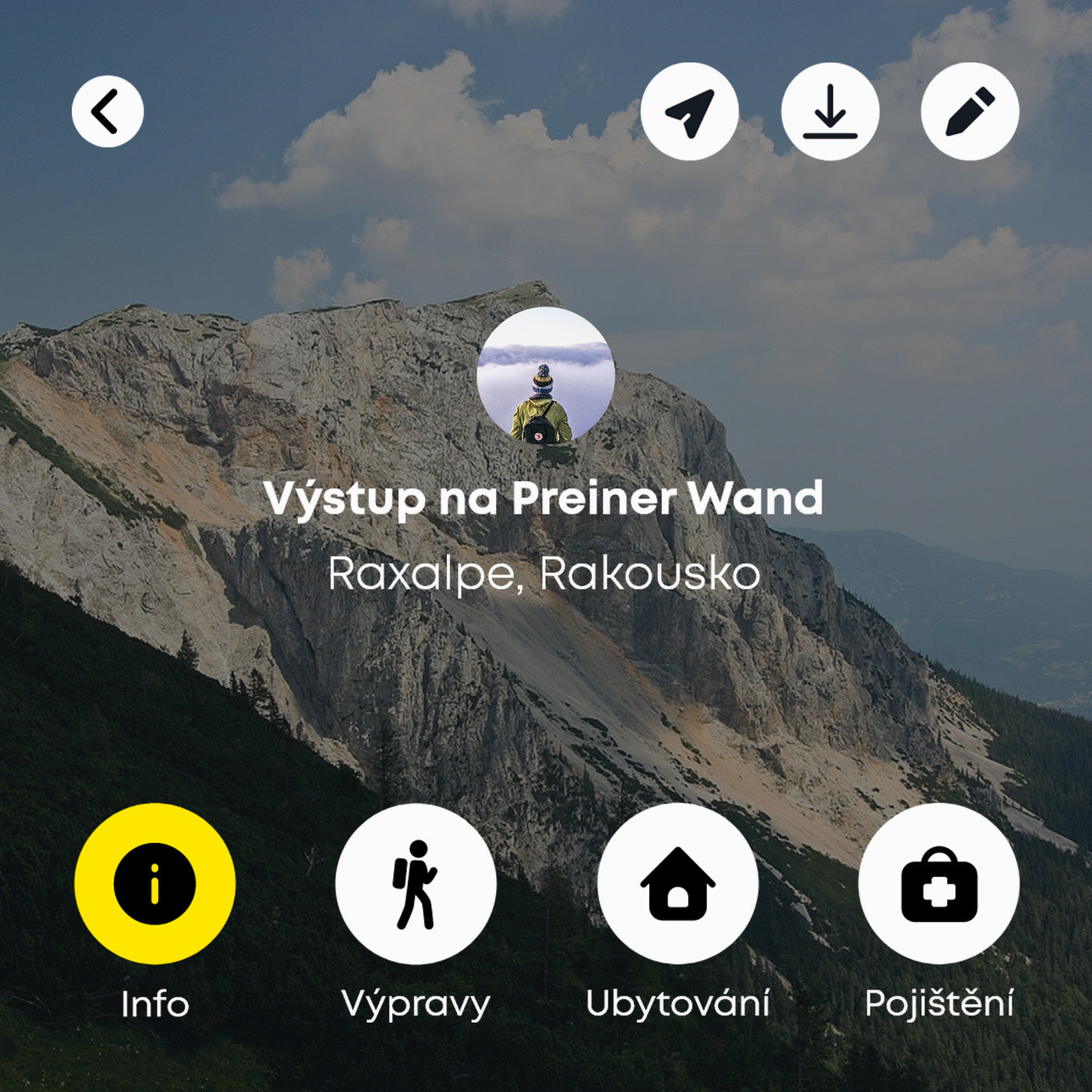
Publikuj
You can find the route on your profile after saving. Your authorship is printed on the route in the form of a profile photo. People can click through this photo to your profile.
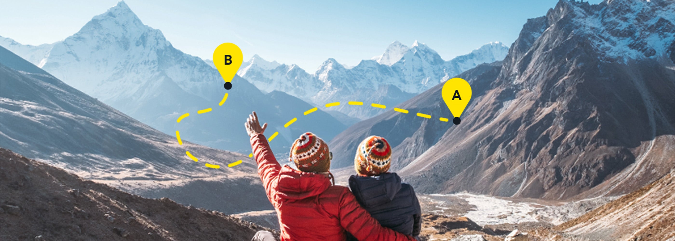
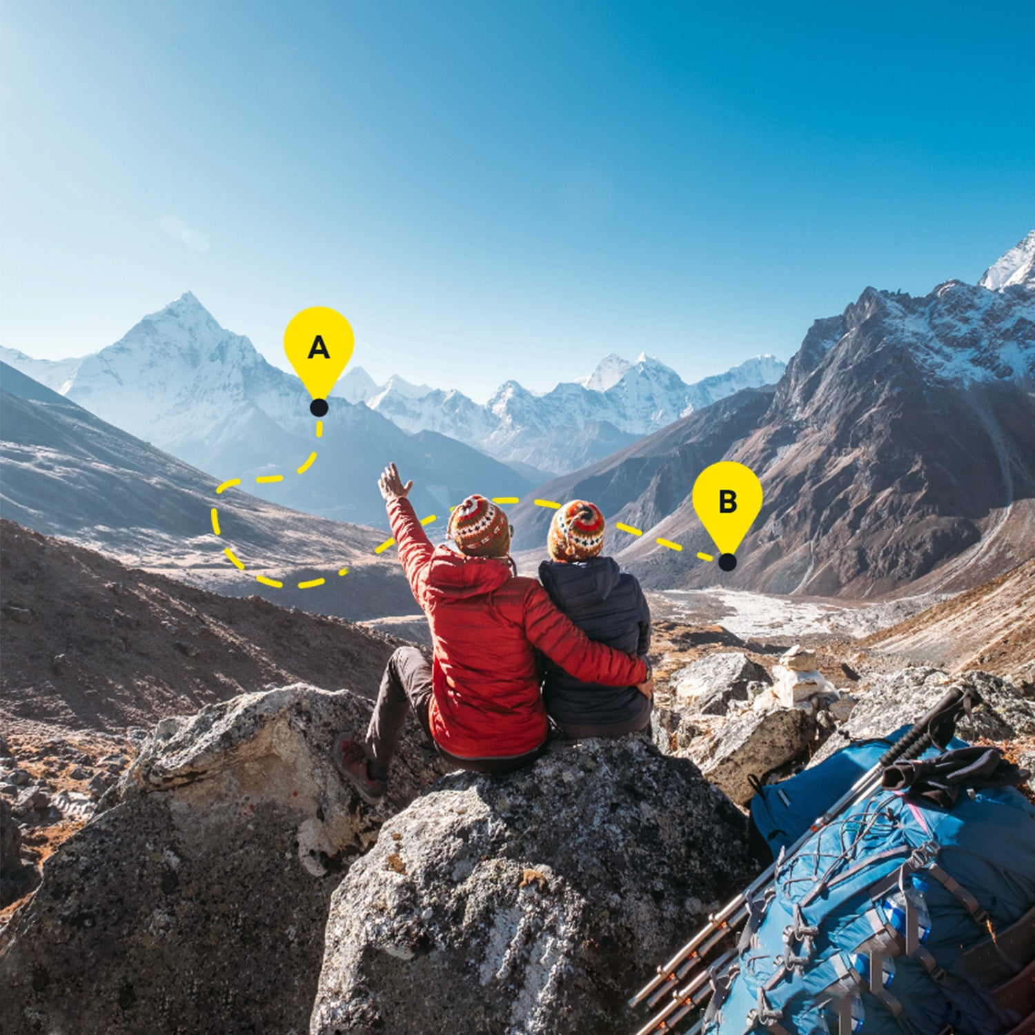
Plánuj dobrodružství
pro komunitu dobrodruhů
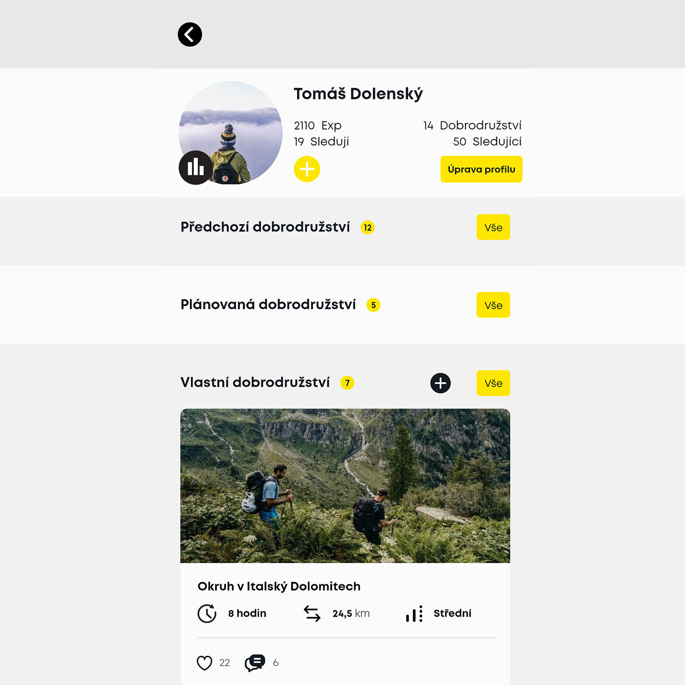
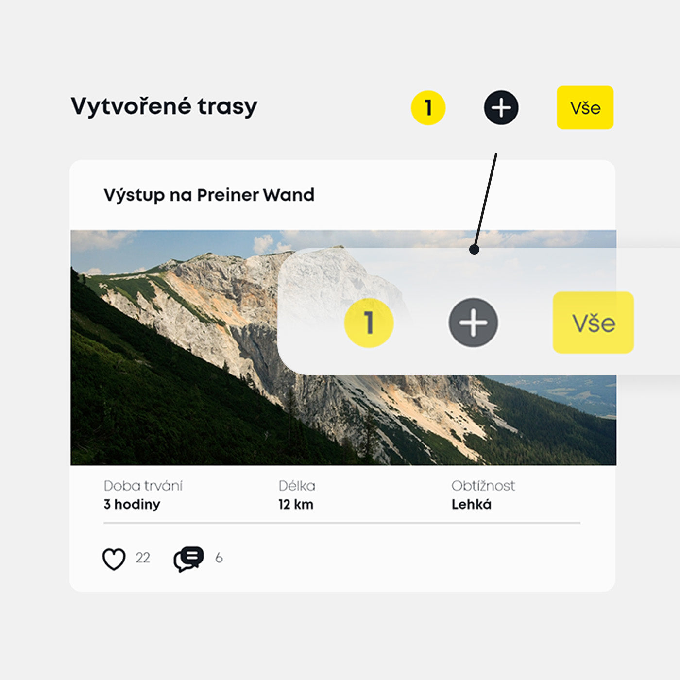
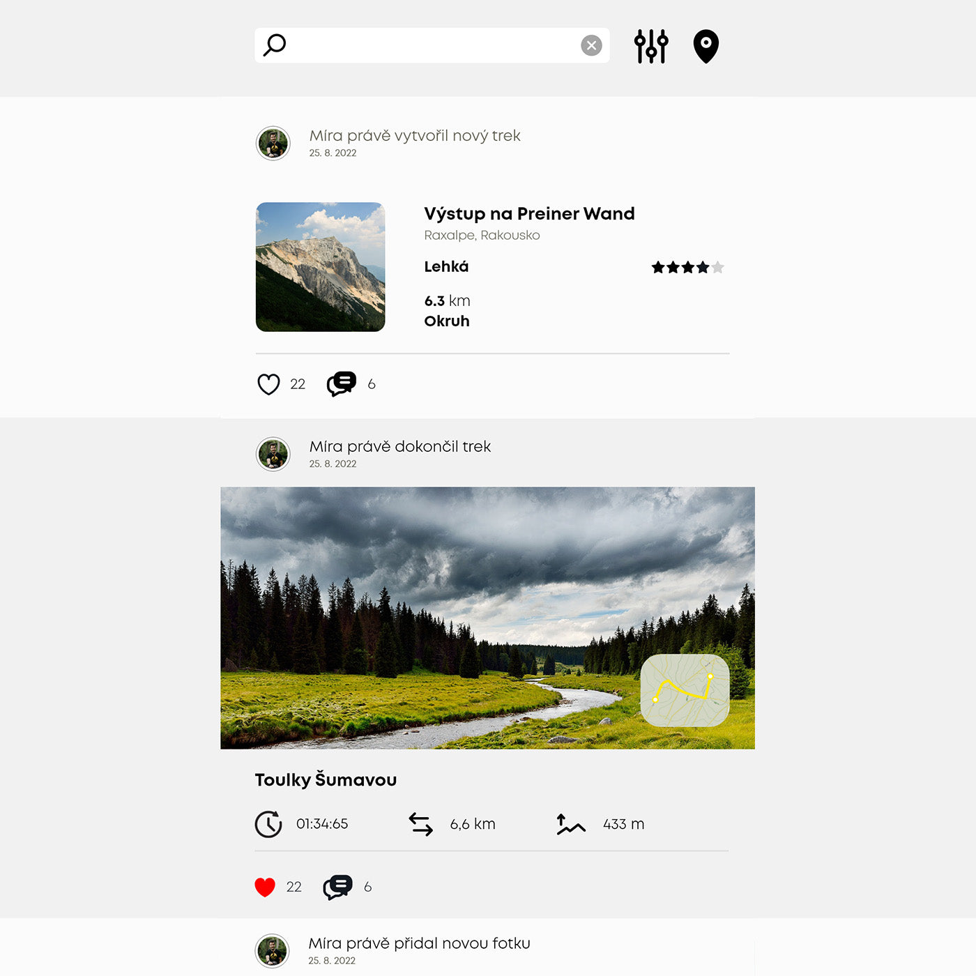
Tvé vytvořené trasy
All the adventures you've planned can be found on your profile in the Created Routes section and will also appear in the feed of posts to people who follow you.
If you want to edit the route back or add something to it, just click on the pencil icon in the route details in the left corner. You can use this button to expand the route further.
Feed příspěvků
Tvoříme komunitu nadšenců do cestovní a dobrodružství. Věříme, že je důležité se navzájem inspirovat a obohacovat. Proto jsme vytvořili feed příspěvků, kde uvidíš obsah od lidí, které sleduješ anebo zde můžeš inspirovat ostatní.
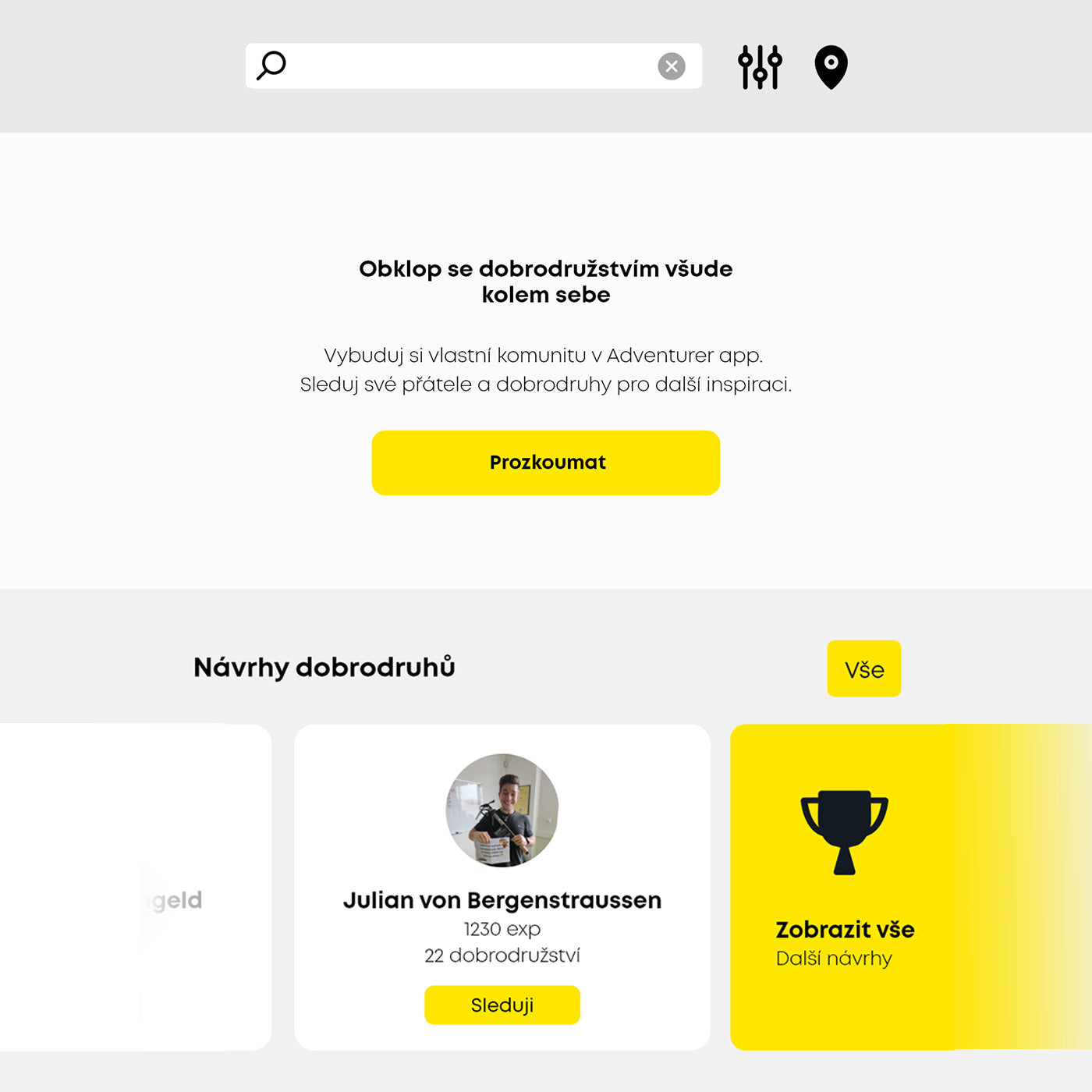
Komunitní feed příspěvků
People who follow you will see your routes and activities, and you can see content from people you follow. You can respond to posts with likes and comments.
Vyzkoušet plánovačFAQ
Nejčastější dotazy
Kde získám GPX soubor?
You must first create a GPX file through a map provider such as MapyCZ, Google or use the maps on our website. Export the GPX file and upload it to your mobile phone.
You can use Google drive or other cloud storage to upload the GPX file to your mobile, forward it through a chat tool such as messenger, through an email attachment, or download it to your mobile through the map provider where you created the GPX.
Co se stane po importu GPX?
The route planner will open. The planner is intuitive and guides you through the whole process.
The first thing you'll see is a map, where you can double-tap to record points along the route. In the next sections you can add details, descriptions and upload photos. Once saved, you'll find your trek on your profile.
Můžu po publikování trasu znovu upravovat/aktualizovat?
Yes, you can find the route you created on your profile. There is a pencil icon in the left corner of the route detail. You can edit the route via this button.
How can I delete my trail?
First, find the route you created on your profile. There is a bin icon in the right top corner of the trail detail. You can delete the trail via this button.
Jak vložím bod na trasu?
Simply tap the map twice and a list of various points of interest will open, which you can record on the route map for a quick overview.
Jak změním pozici bodu na trase?
Just hold the point with your finger and drag it across the screen to change position.
Jak vymažu bod na mapě?
Double-click the point again and you will see a Delete button at the bottom of the screen.
Co, když nechci aby ostatní viděli mé trasy?
If you set your profile to private, no one but you will see your routes, not even the people who follow you. You can find the privacy settings on your profile under the "Edit profile" button.